Return to Home Page

Canadian and U.S. 8-Hour Ozone Levels

Based on 2007-2009 Data

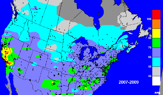
Map created by Environment Canada using ozone data NAPS and AQS
databases and contouring done using Mapgen Version 2 (the AIRNOW mapping program).
Presented courtesy of A.S.L. & Associates, Helena, Montana.

Home Page | News | Corporation | Maps | Publications | Table of Contents | Multimedia Center

Copyright © 1995-2024 A.S.L. & Associates. All rights reserved.